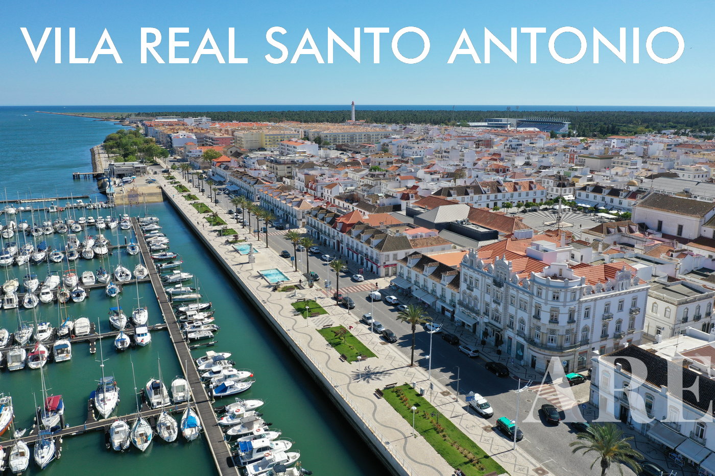
This post groups the maps used in the various articles on this site, in order to facilitate consultation. For more in-depth knowledge about the location of southern Portugal that each map refers to, we have placed a link in the caption of each map, so that you can be directed to the article with more photos and information. A useful article, to share with those you like…!
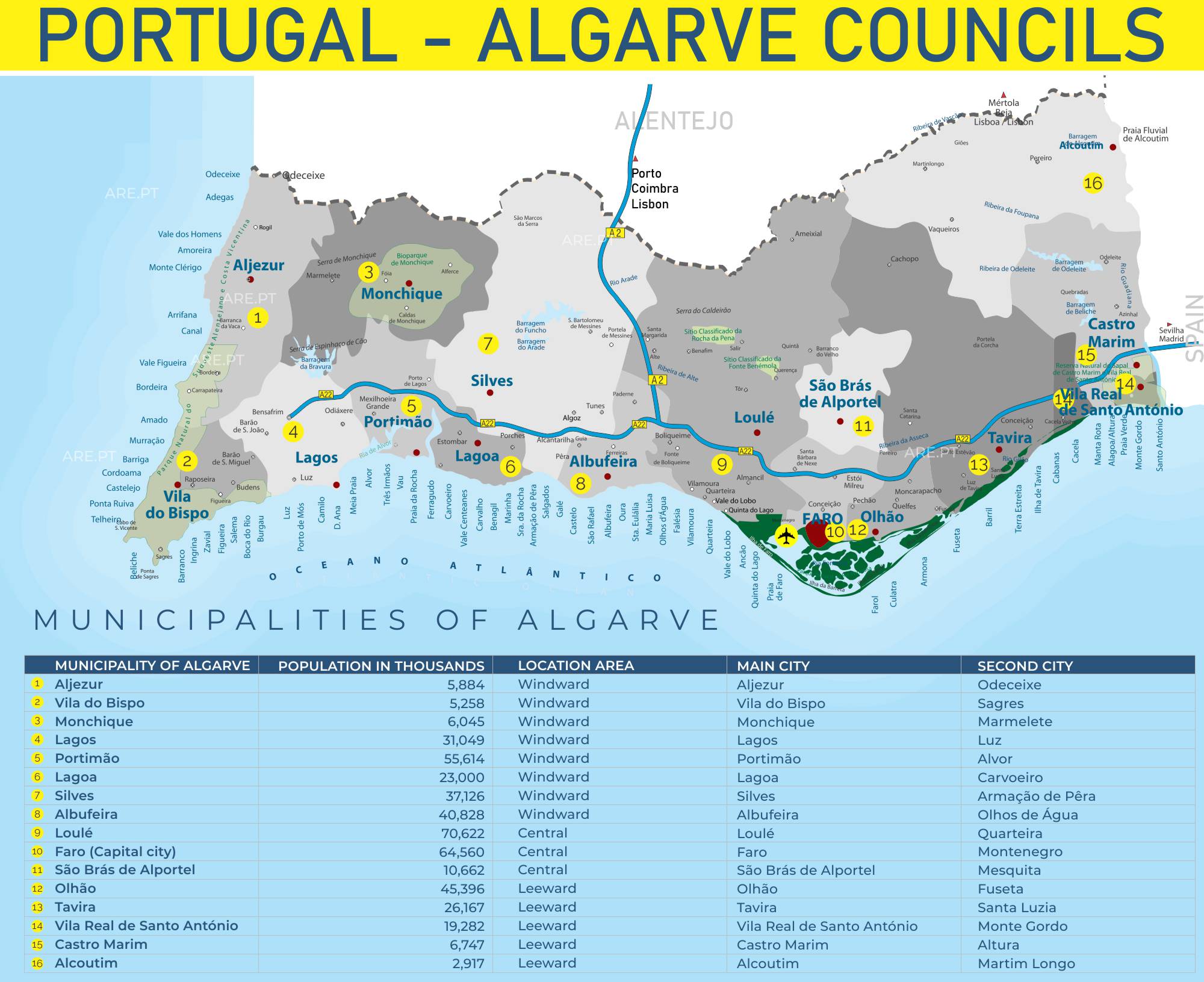
Map of the 16 municipalities of the Algarve, a coastal area with a hundred and fifty kilometers of beaches. This map can be found in the article about the Algarve
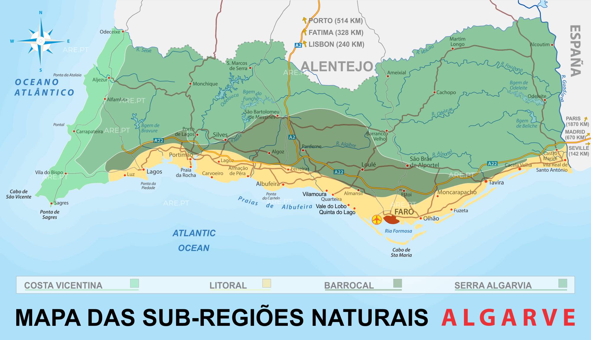
Map of the natural subregions of the Algarve, Costa Vicentina, coast, Barrocal, and Serra Algarvia. This map can be found in the article about the Algarve
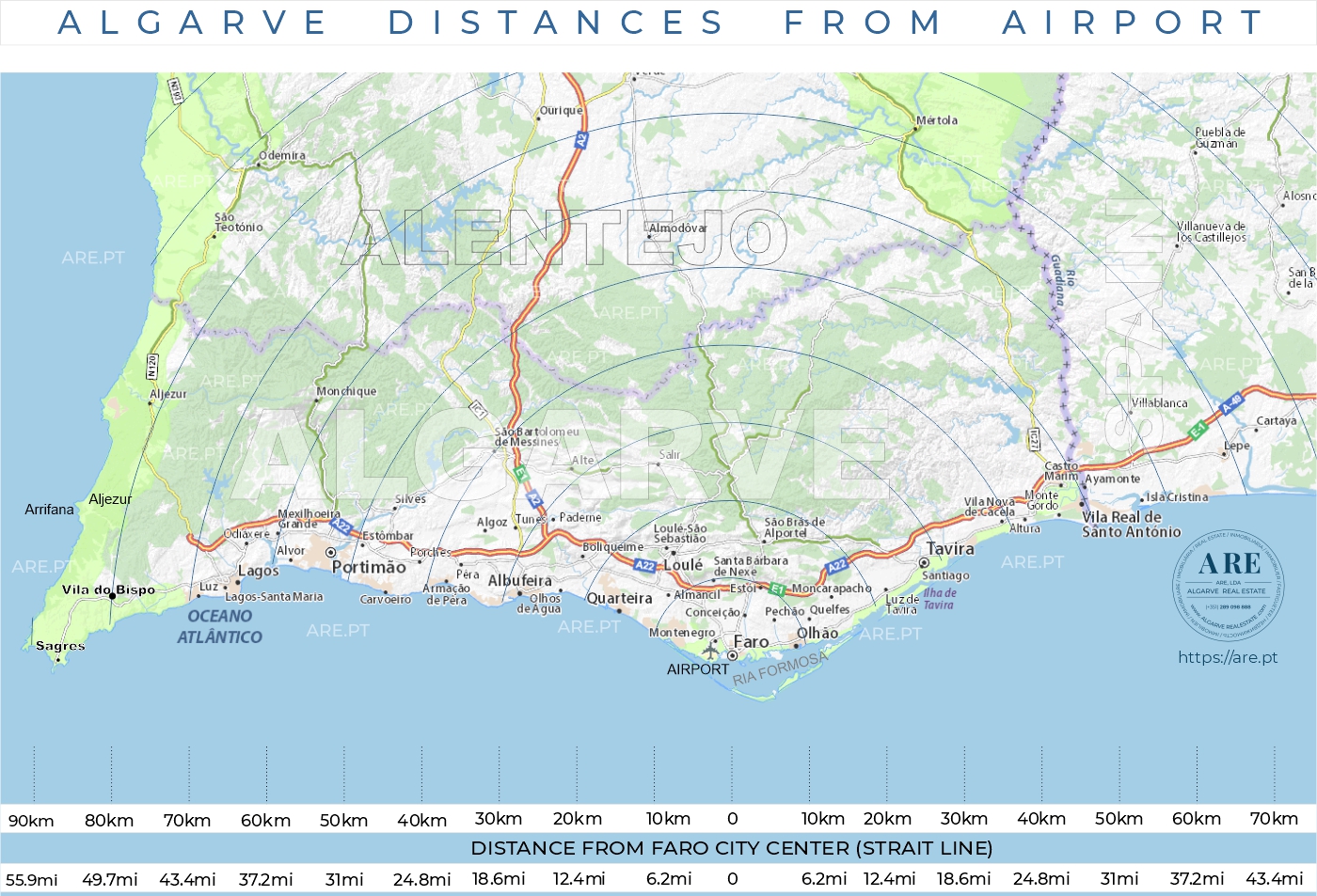
Map of the Algarve with distances between locations in kilometers and miles. This map can be found in the article about the Algarve
Leeward Algarve Maps
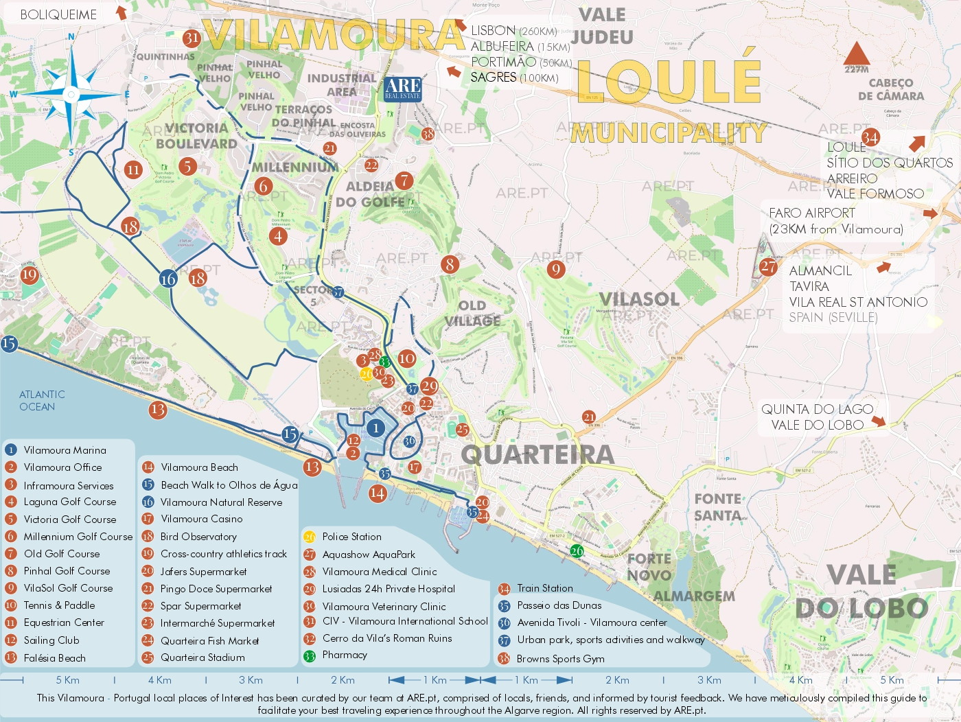
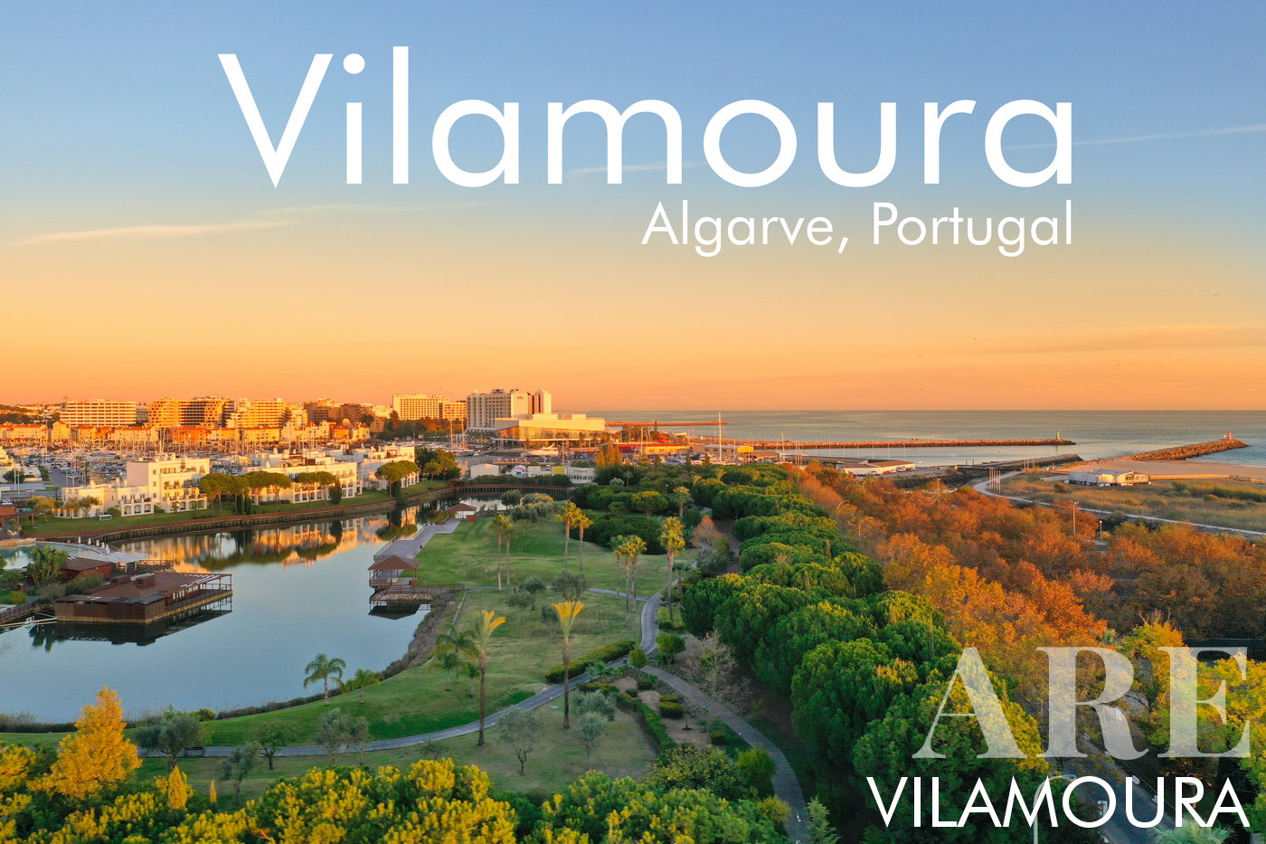
Map of Vilamoura Resort and surroundings. This maps belongs to the Vilamoura article
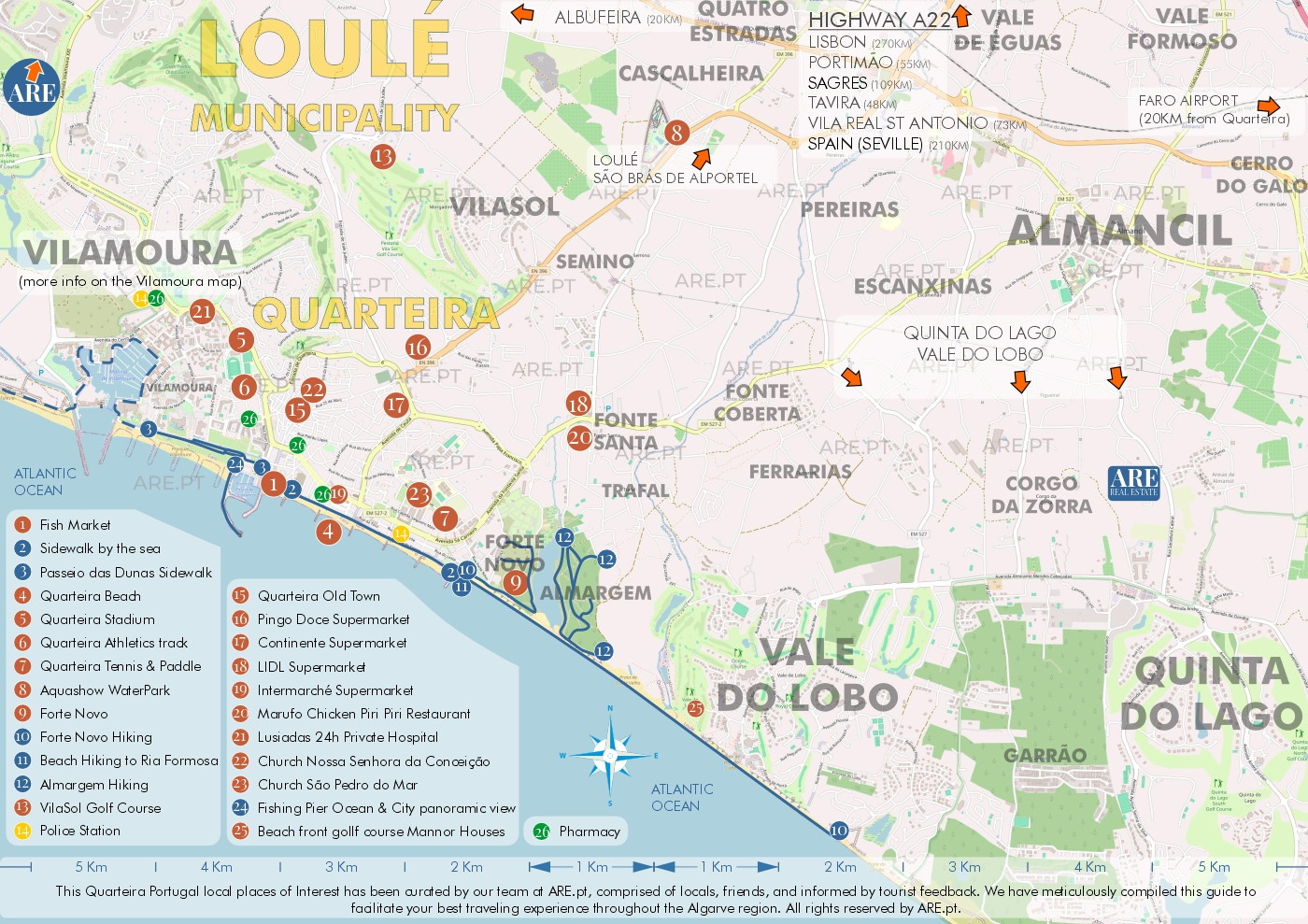
Map of Quarteira and surroundings. This maps belongs to the Quarteira article
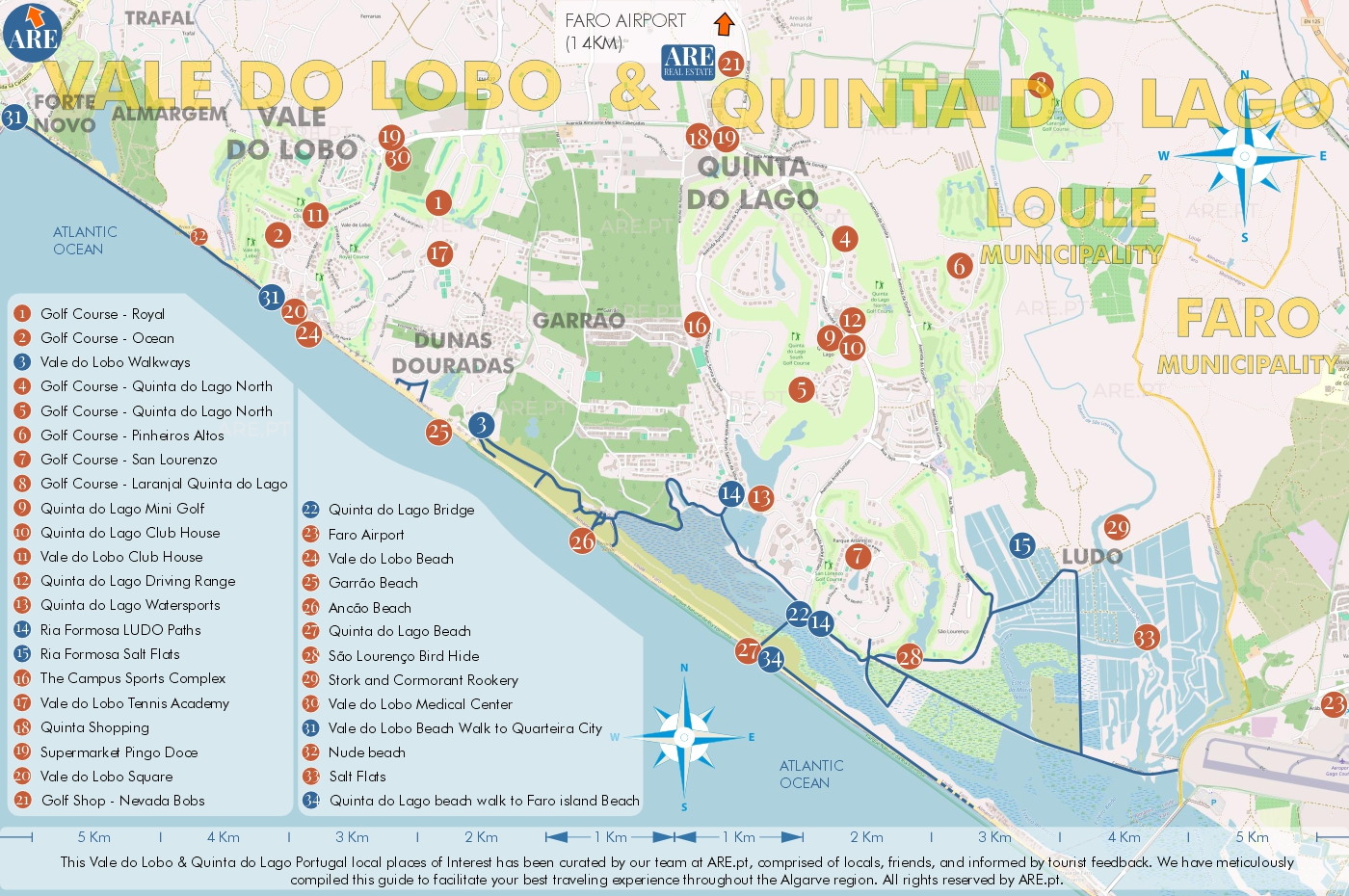
Map of the resorts of Vale do Lobo and Quinta do Lago, and surroundings. This maps belongs to the Vale do Lobo article
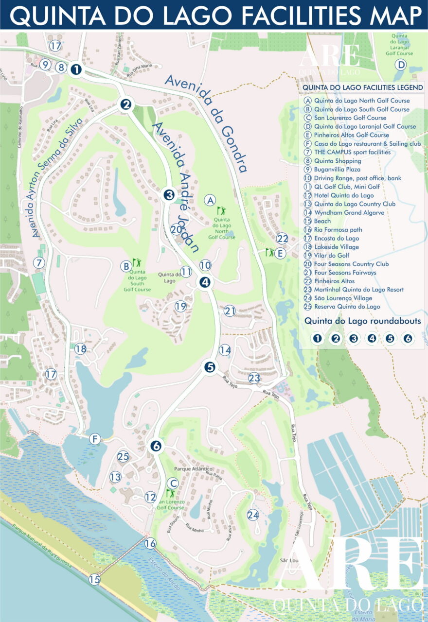
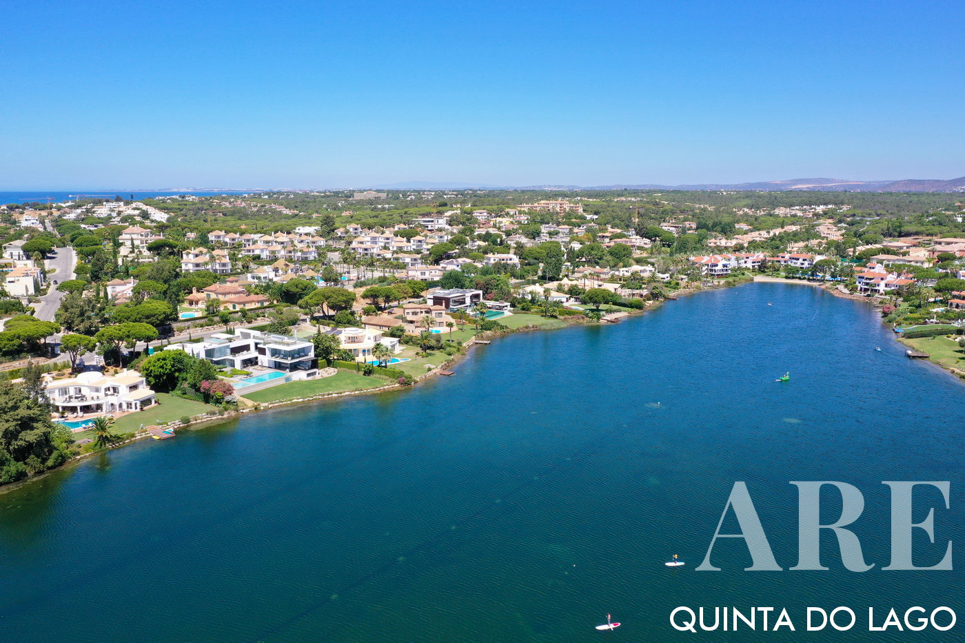
Map of Quinta do Lago resort. Thsi maps belongs to the Quinta do Lago article
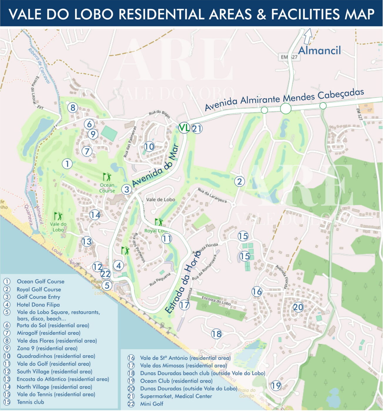
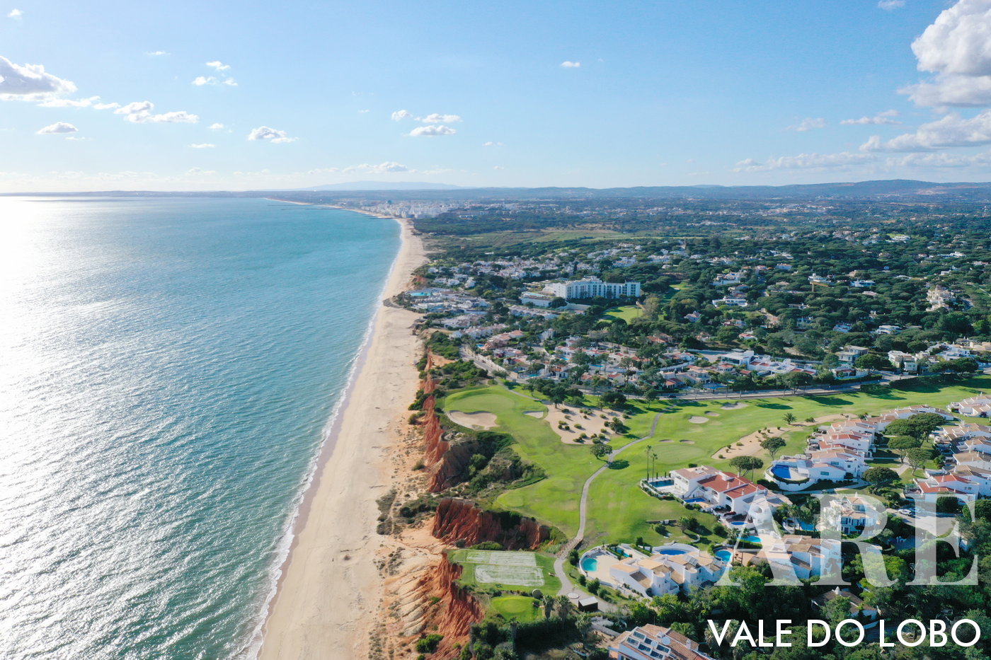
Map of Vale do Lobo resort. Thsi maps belongs to the Vale do Lobo article

Map of Almancil and surroundings. This maps belongs to the Almancil article
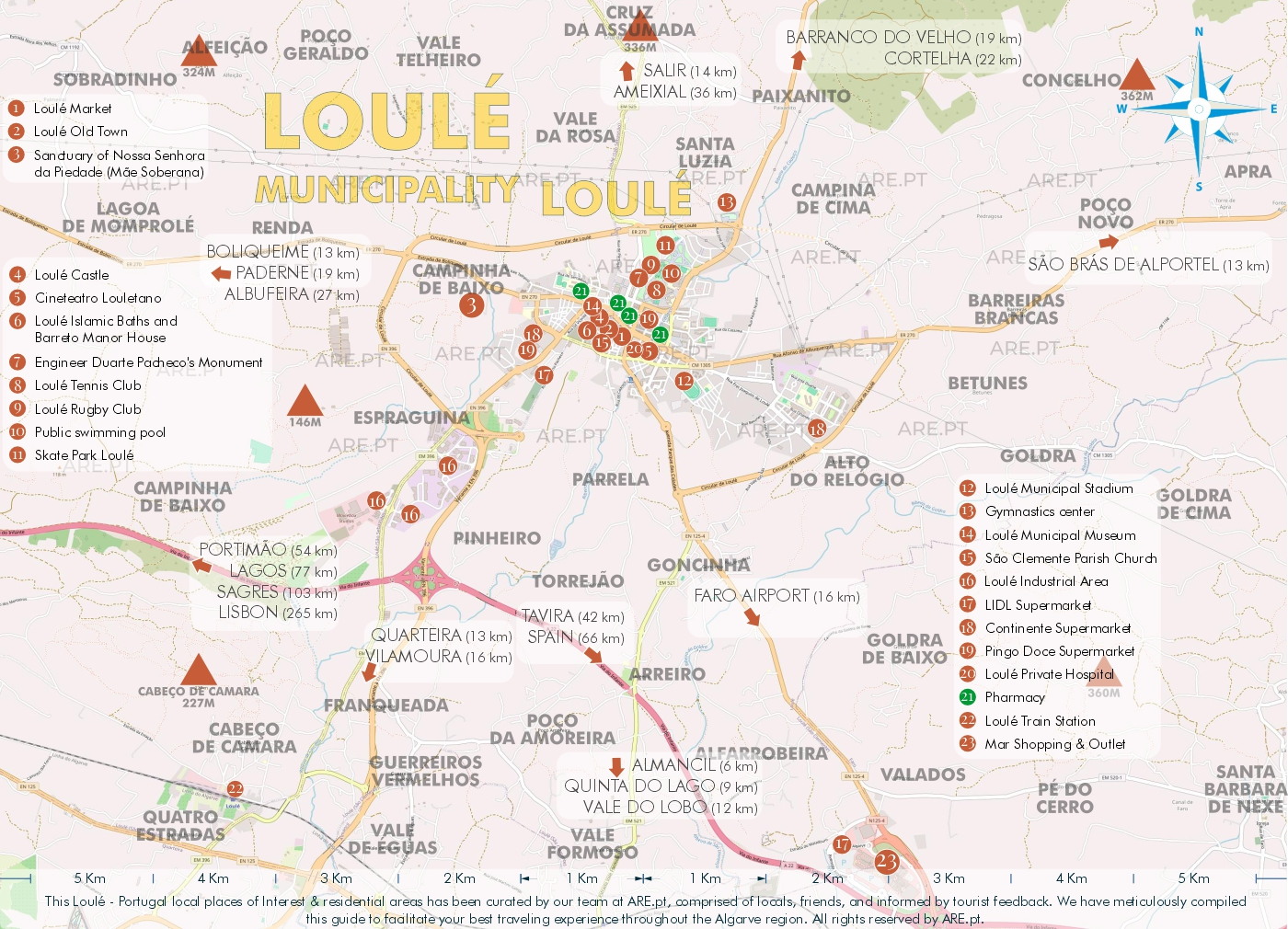
Map of the city and surroundings of Loulé. This maps belongs to the Loule article
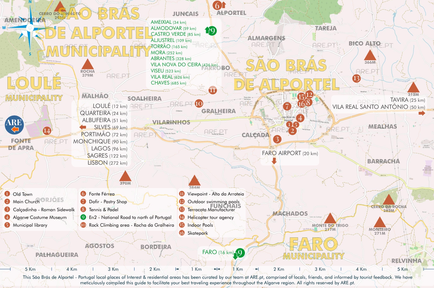
Map of São Brás de Alportel and surroundings. This maps belongs to the São Brás de Alportel article

Map of Faro and surroundings. This maps belongs to the Faro article
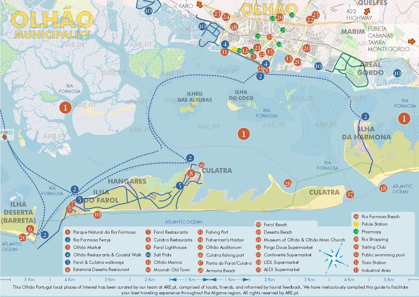
Map of Olhão and surroundings. This maps belongs to the Olhão article
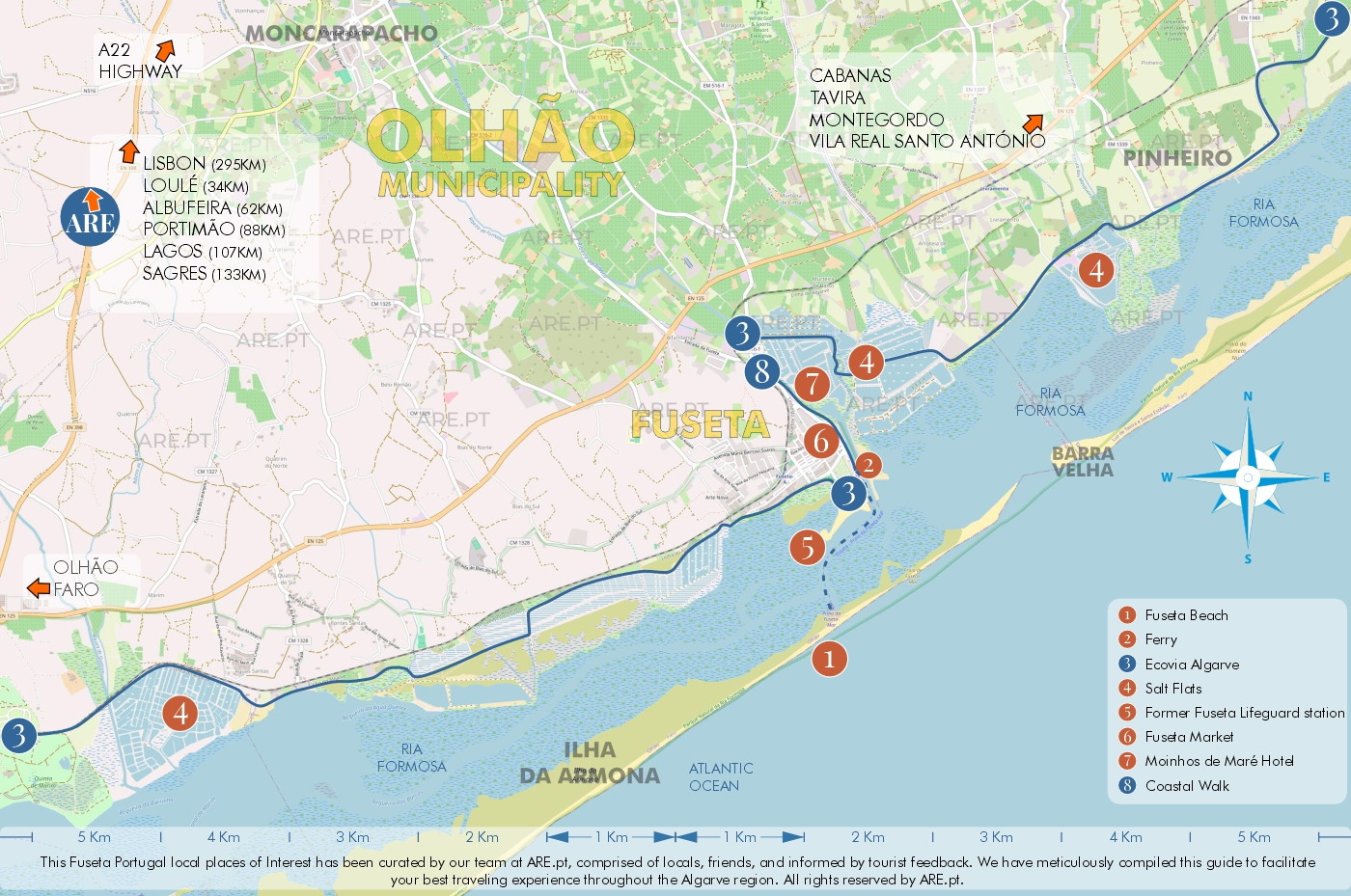
Map of Fuseta and surroundings. This maps also belongs to the Fuseta article
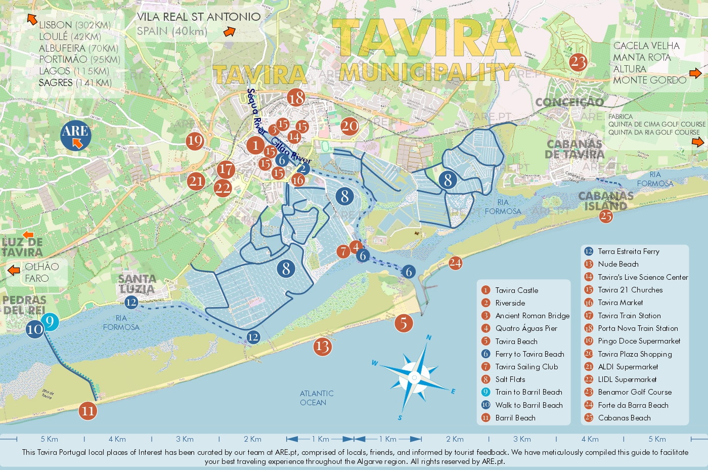
Map of Tavira and surroundings. This maps belongs to the Tavira article
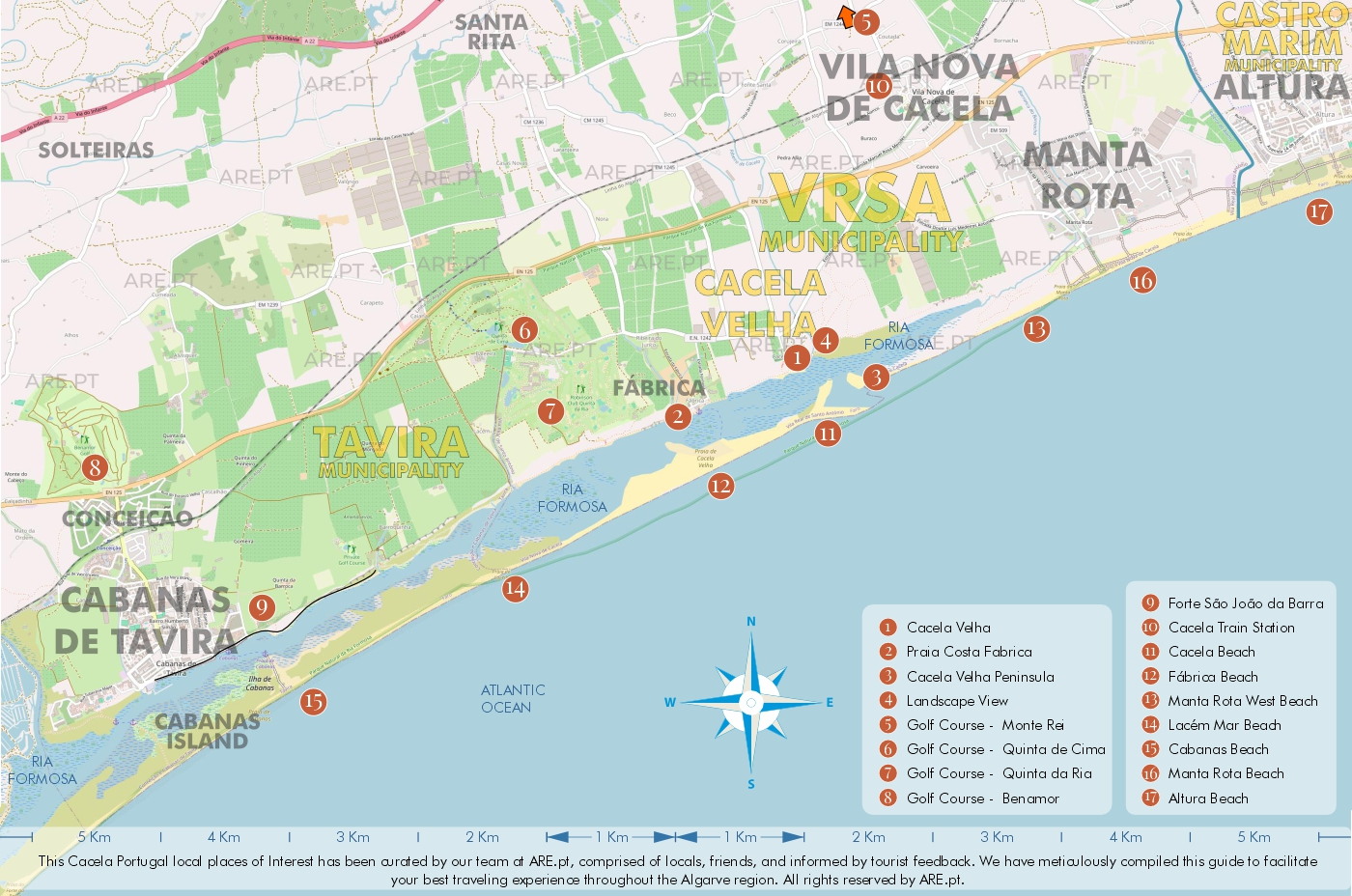
Map of Cabanas de Tavira, Cacela Velha and surroundings. This maps belongs to the Cacela Velha article
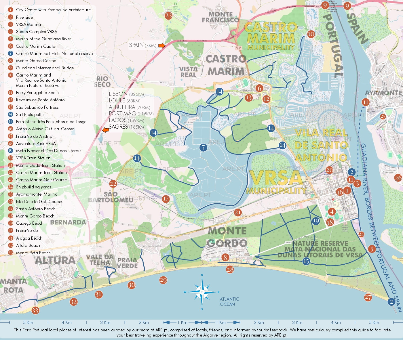
Map of Vila Real Santo António, Castro Marim, and surroundings. This maps belongs to the Vila Real de Santo António article
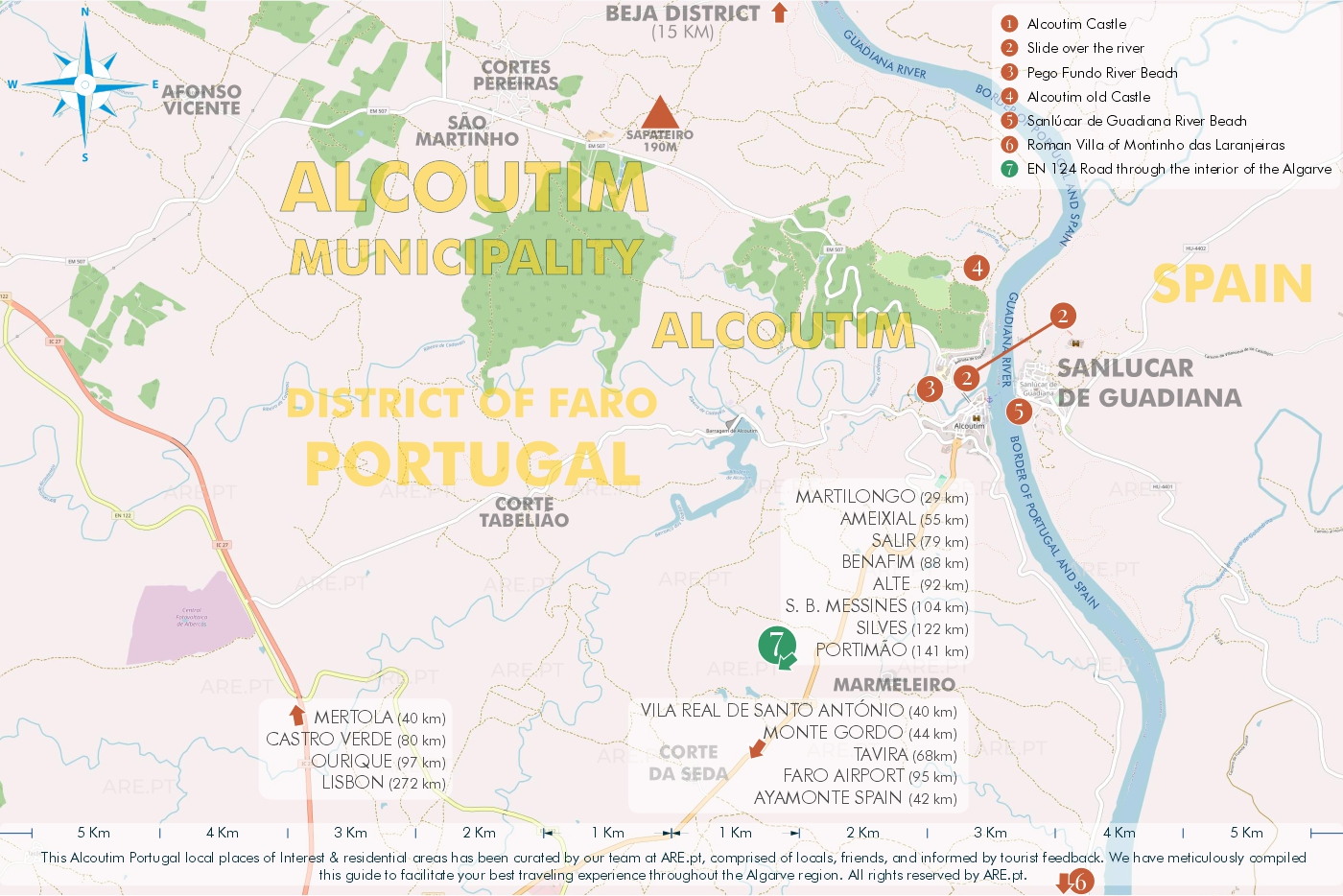
Map of Alcoutim and surroundings. This maps belongs to the Alcoutim article
Windward Algarve Maps

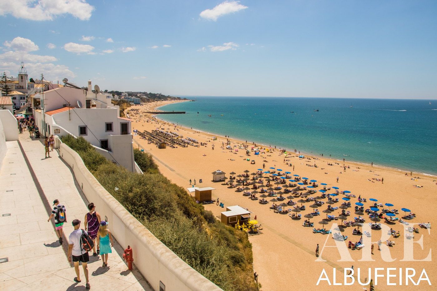
Map of Albufeira and surroundings. This maps belongs to the Albufeira article
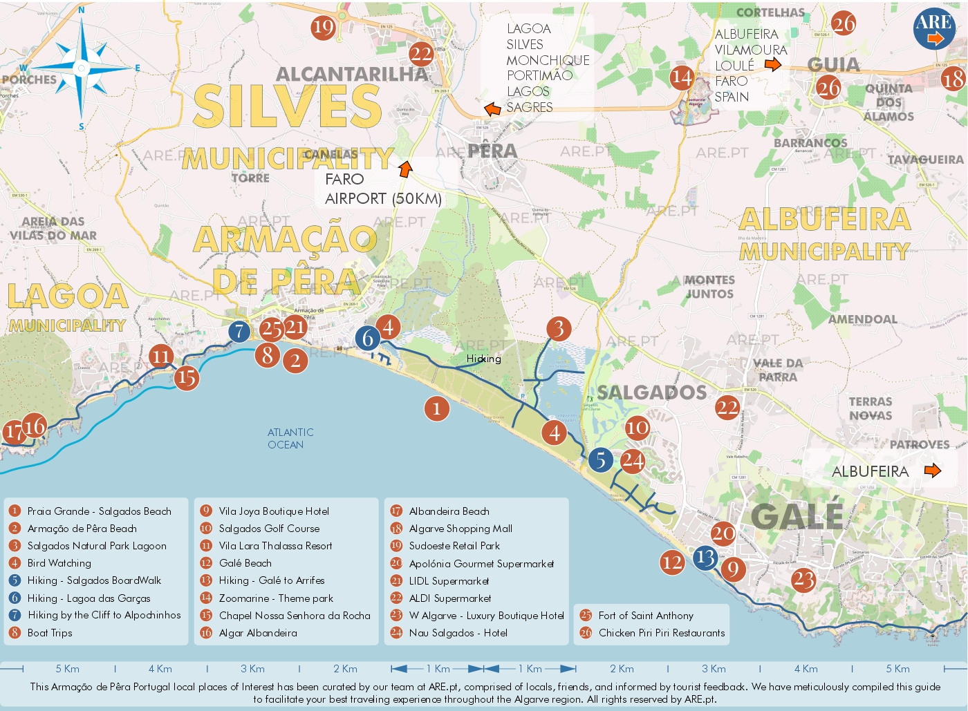
Map of Armação de Pêra and surroundings. This maps belongs to the Silves article
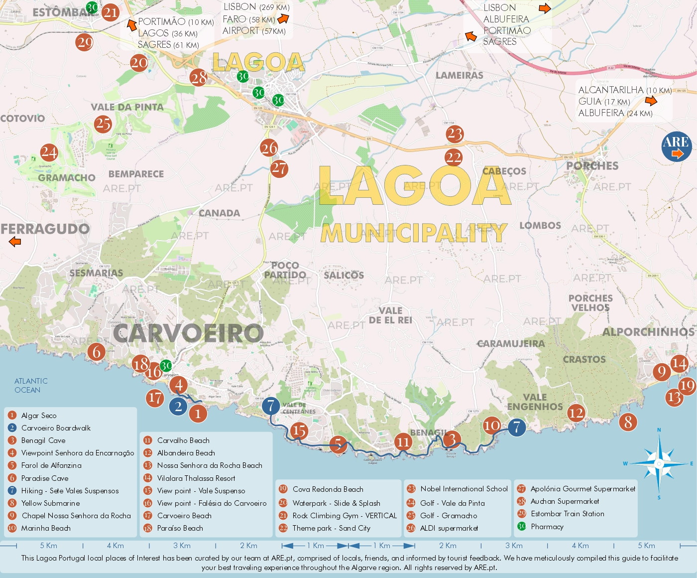
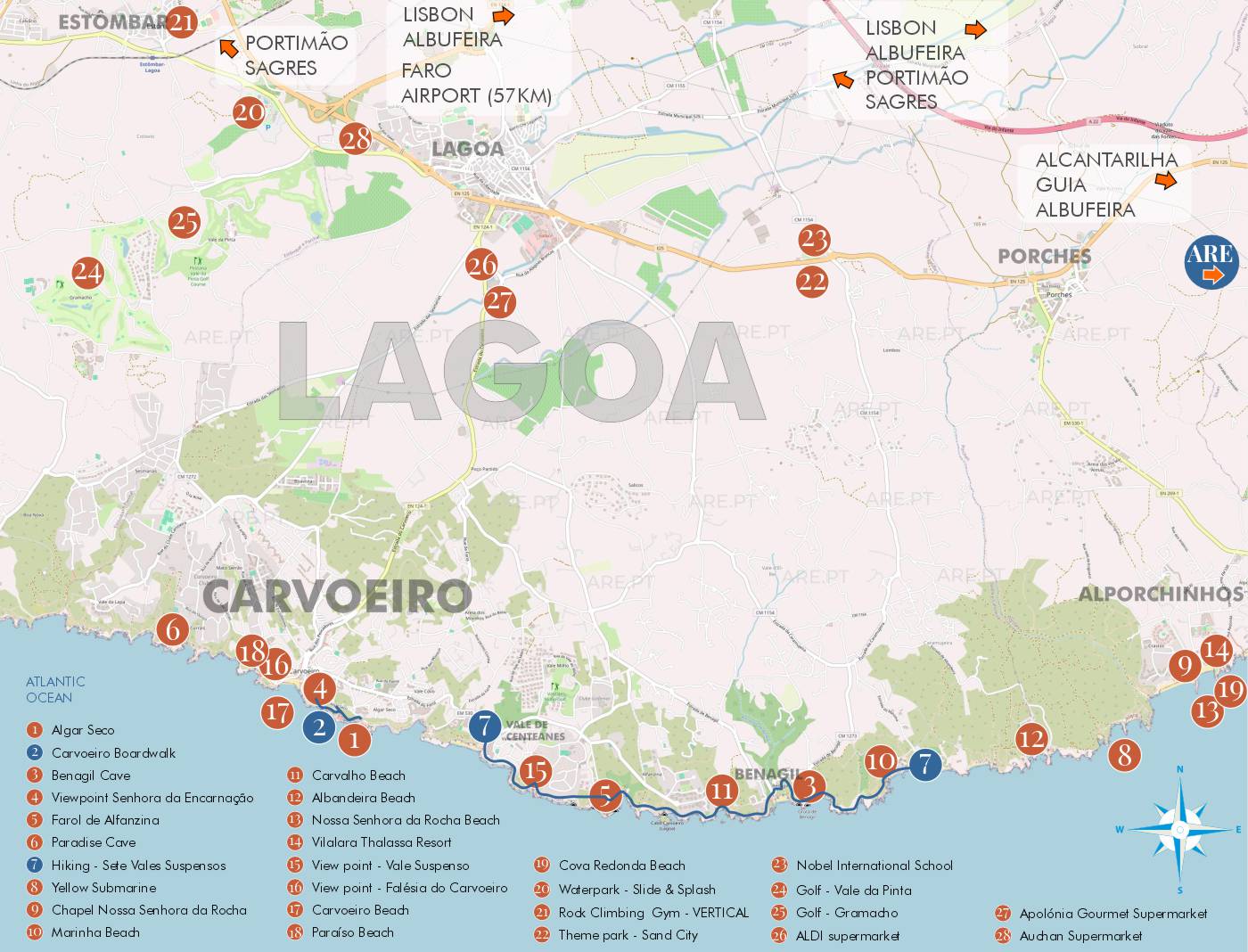
Map of Lagoa and surroundings. This maps belongs to the Lagoa article
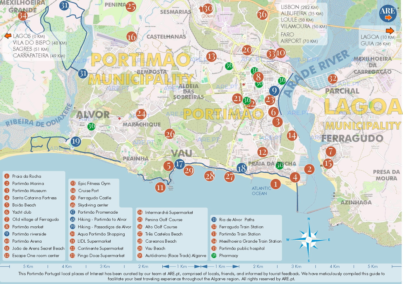
Map of Portimão and surroundings. This maps belongs to the Portimao article
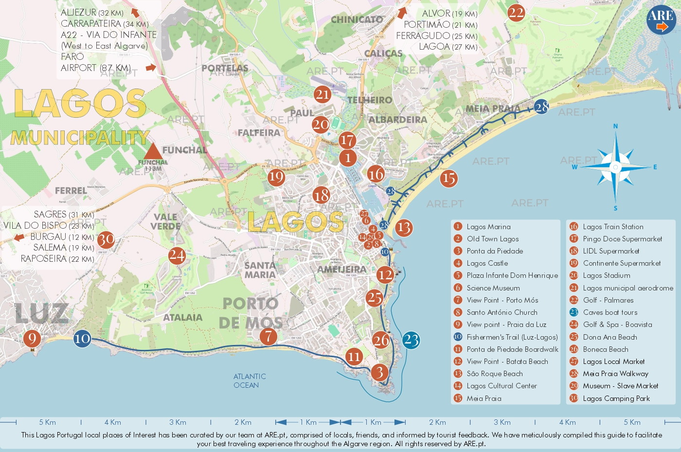
Map of Lagos and surroundings. This maps belongs to the Lagos article
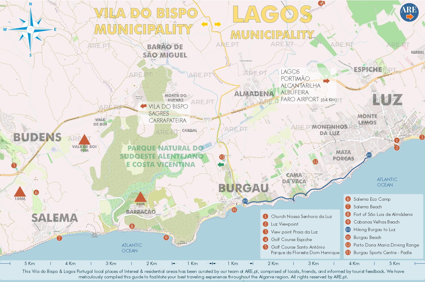
Map of Salema, Burgau and Luz, it’s surroundings. This maps also belongs to the Lagos article
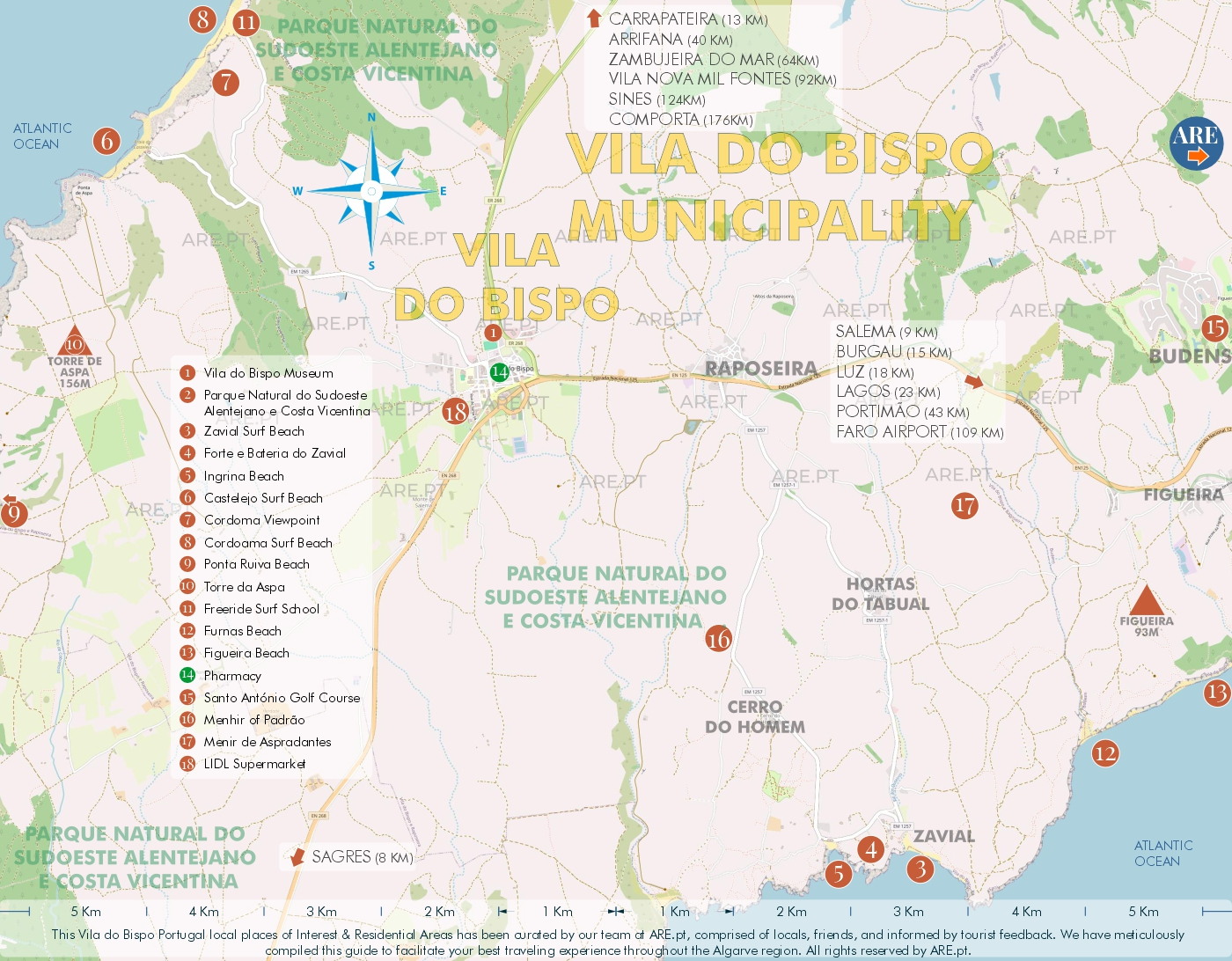
Map of Vila do Bispo and surroundings. This maps belongs to the Vila do Bispo article
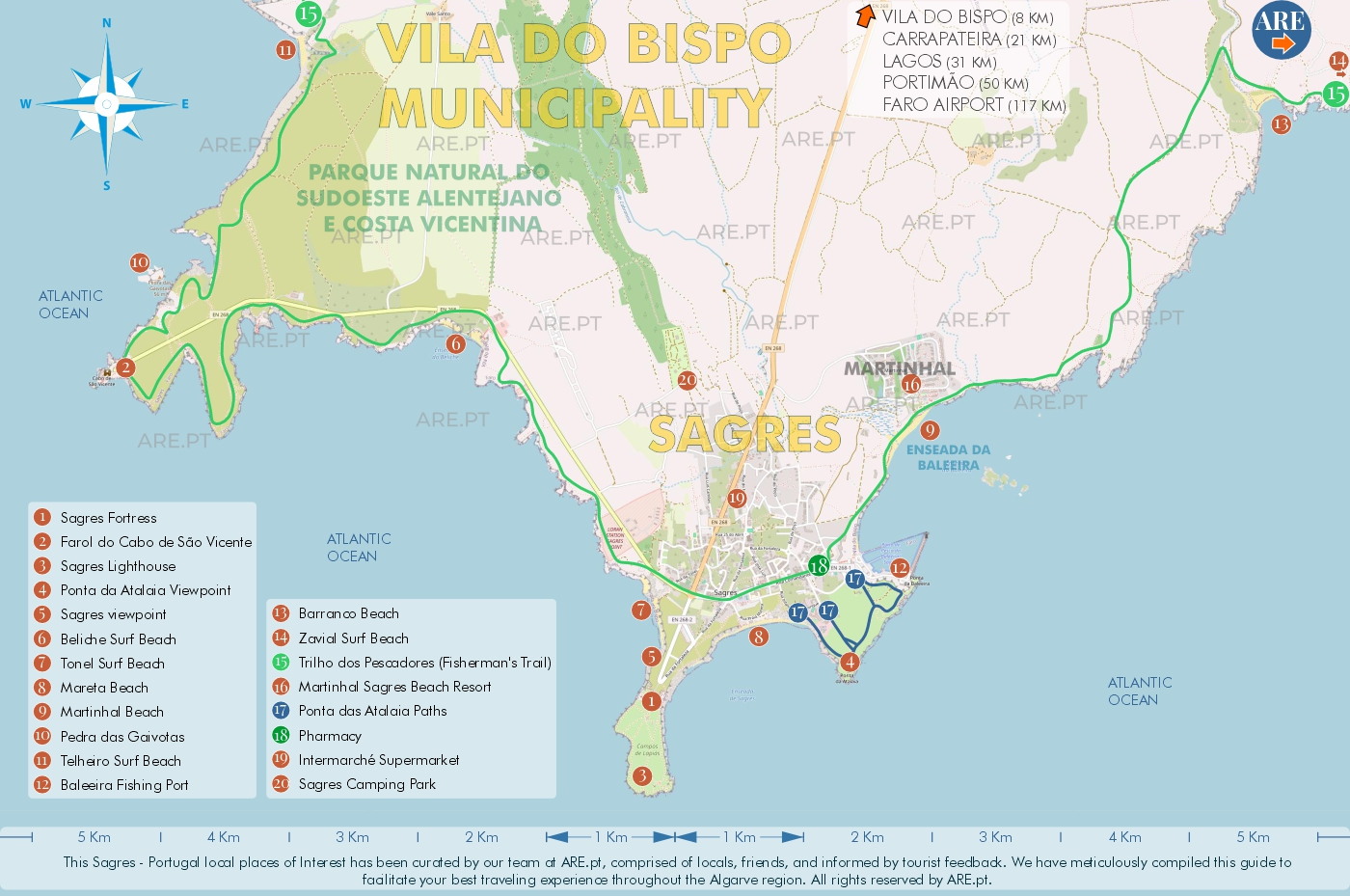
Map of Sagres and surroundings. This maps belongs to the Sagres article
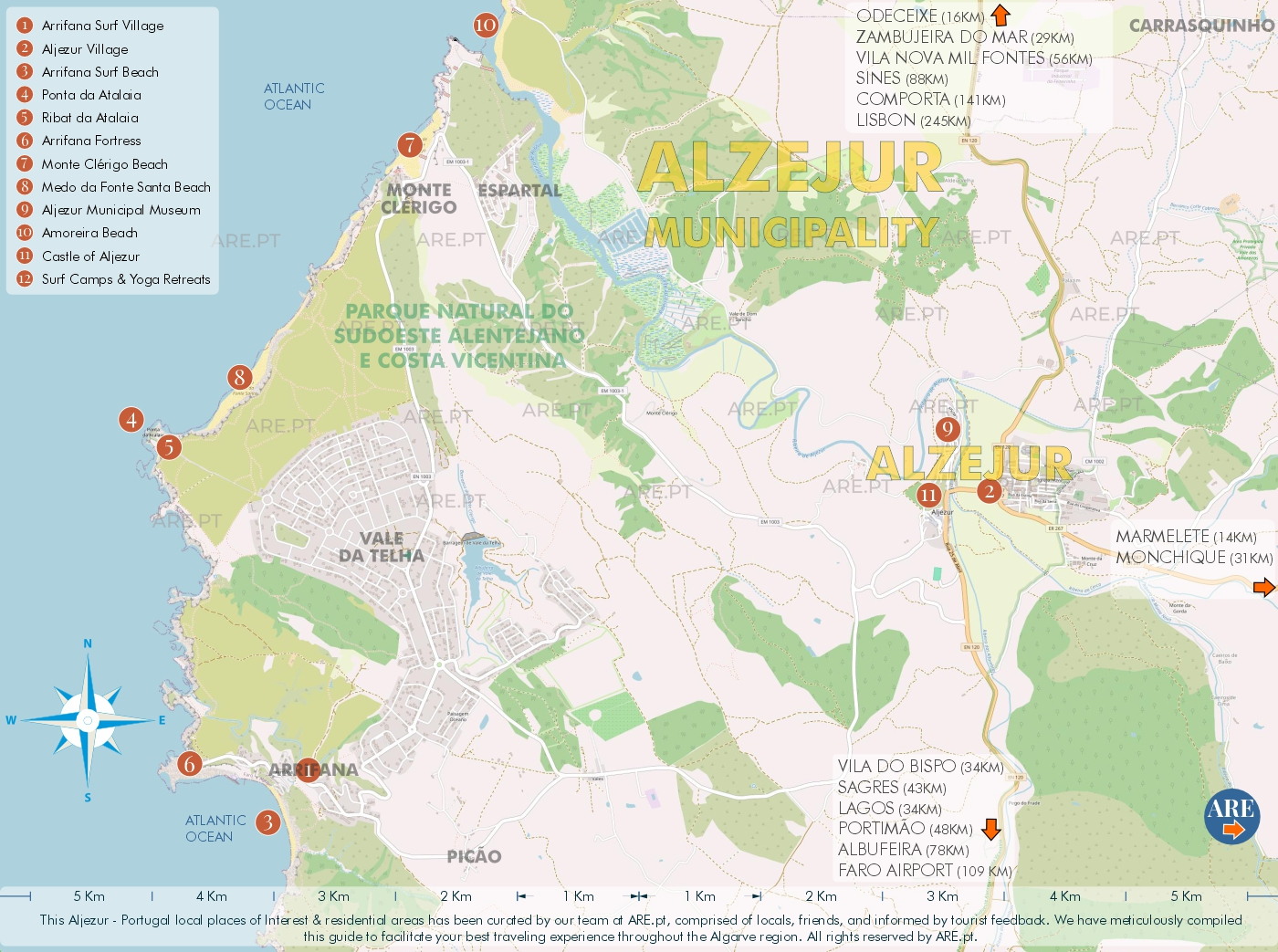
Map of Aljezur and surroundings. This maps belongs to the Aljezur article
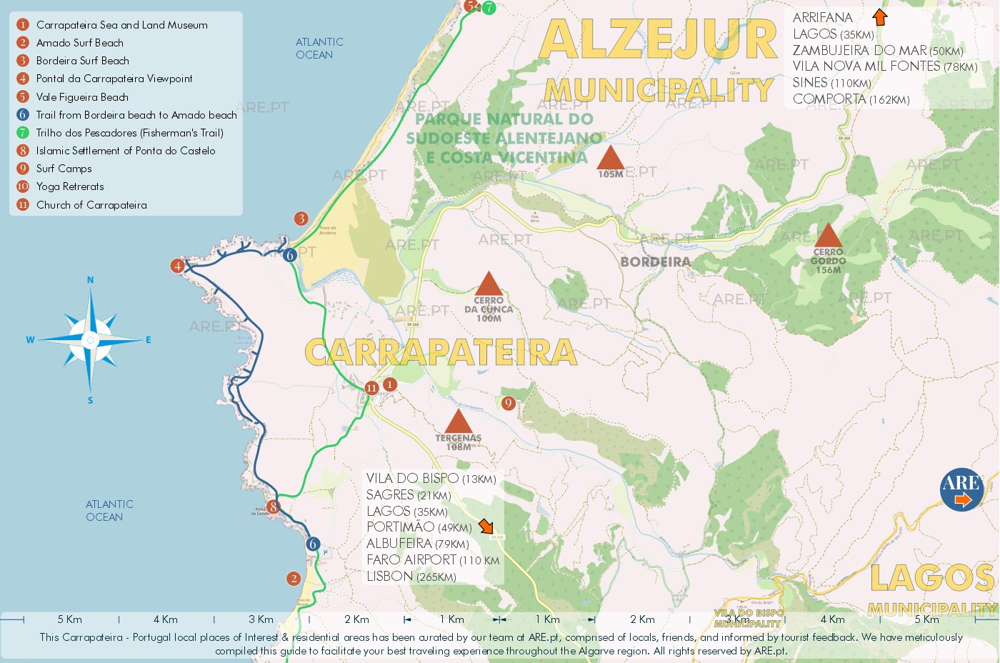
Map of Carrapateira and surroundings. This maps also belongs to the Aljezur article
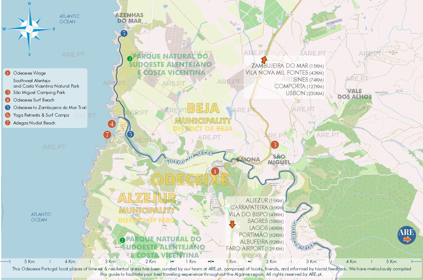
Map of Odeceixe and surroundings. This maps belongs to the Odeceixe article
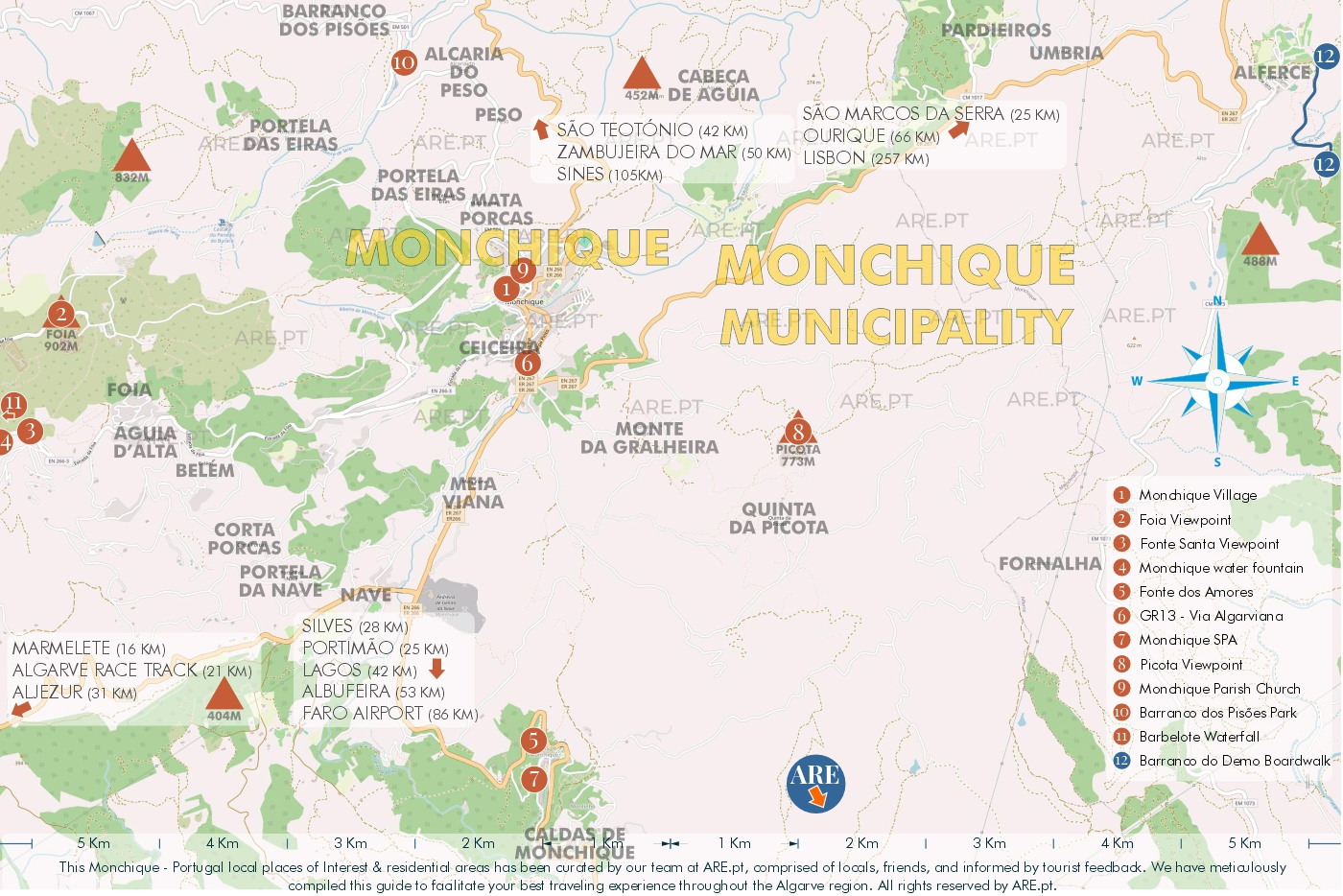
Map of Monchique and surroundings. This maps belongs to the Monchique article
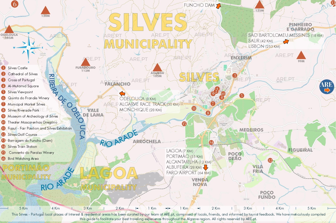
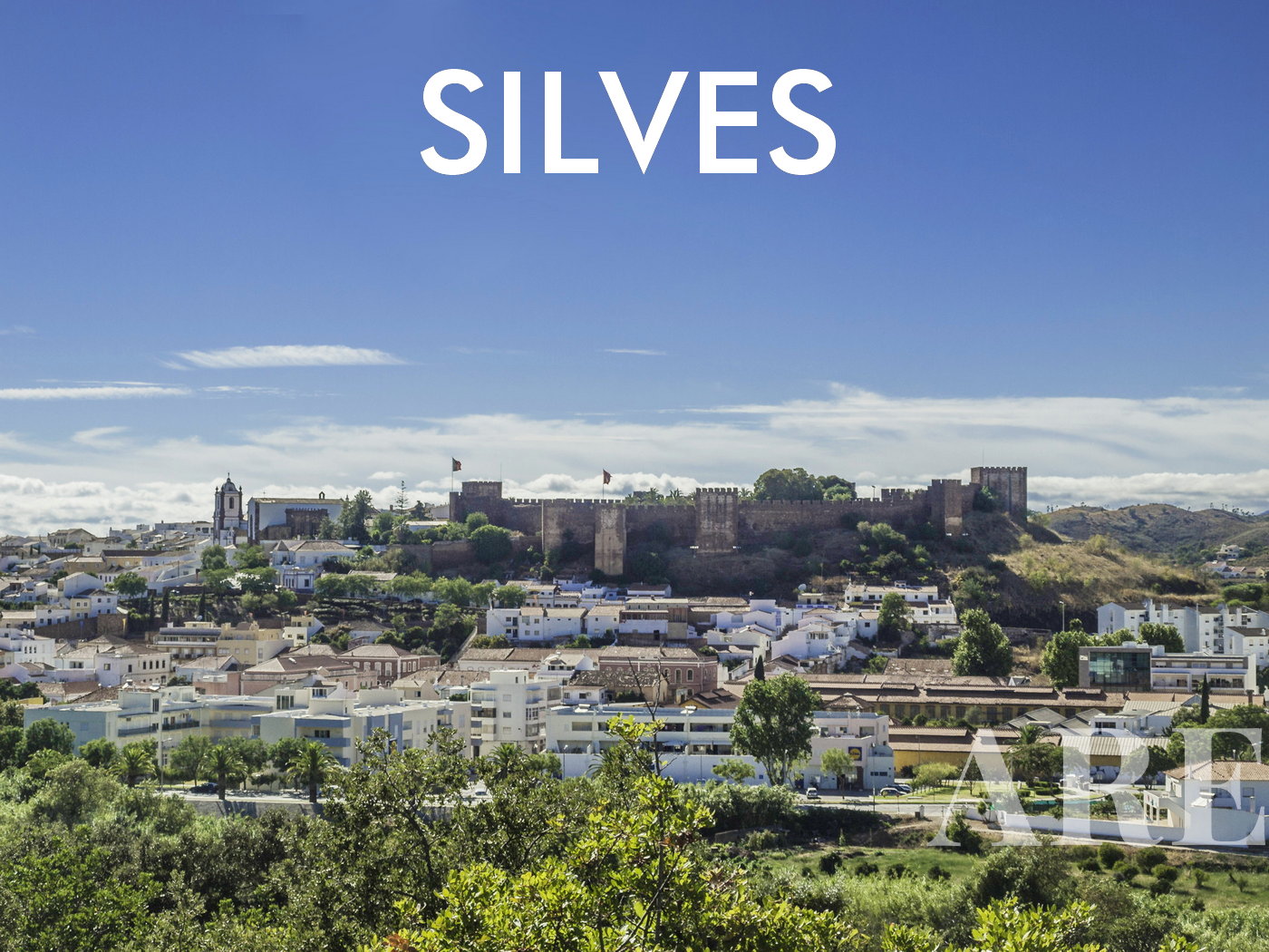
Map of Silves and surroundings. This maps belongs to the Silves article
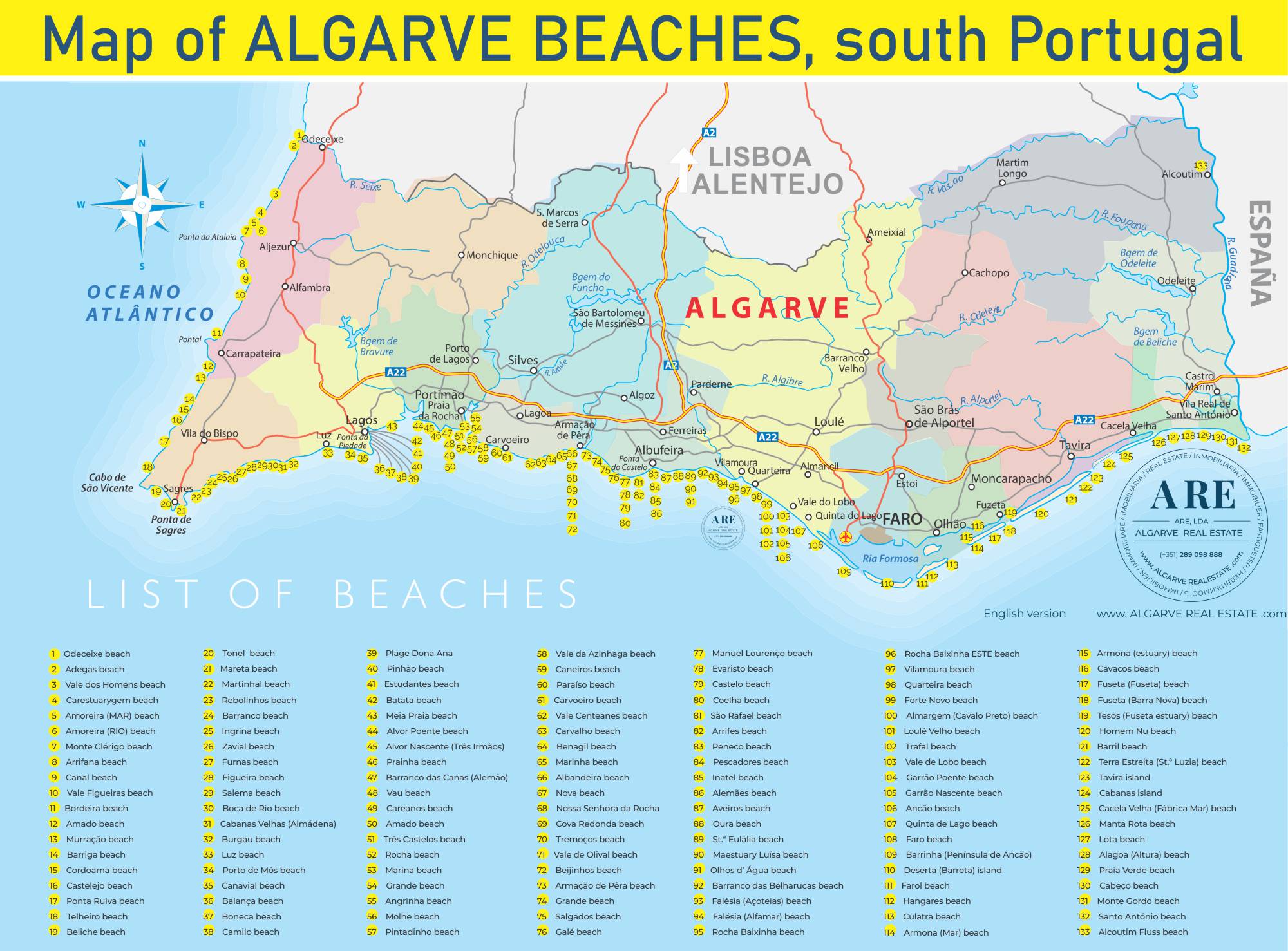
Algarve beach map
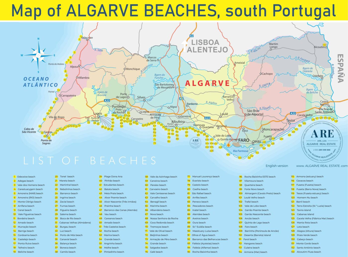
South of Portugal coast has more than 133 beaches for you to discover!
The Algarve beach map was created to help you get to know all the existing beaches along the Algarve coast. This map can be found in the article about Algarve beaches
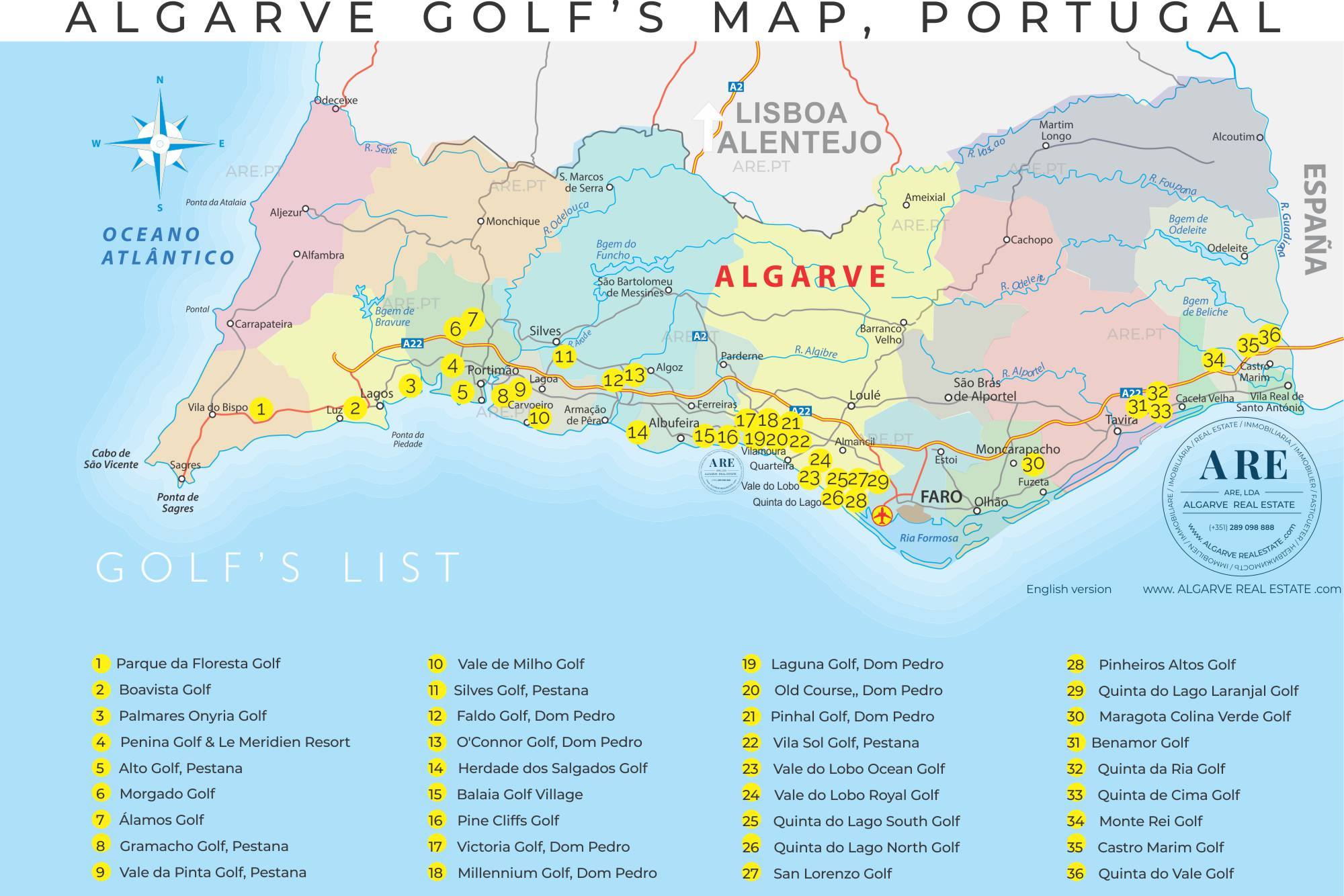
Algarve golf courses map
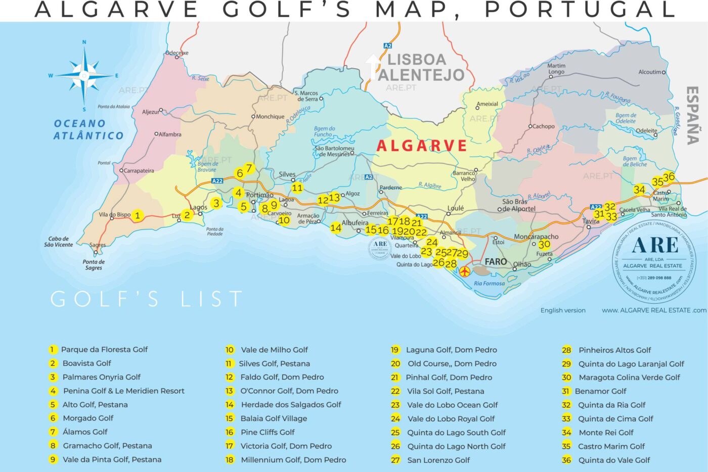
Map of the Algarve indicating 36 golf courses throughout the 16 municipalities. This map can be found in the article about golf courses in the Algarve
Portugal Maps
These following maps on global topics in Portugal are found in the article about Portugal, where we also find links to institutions that may be relevant for those looking to live in Portugal
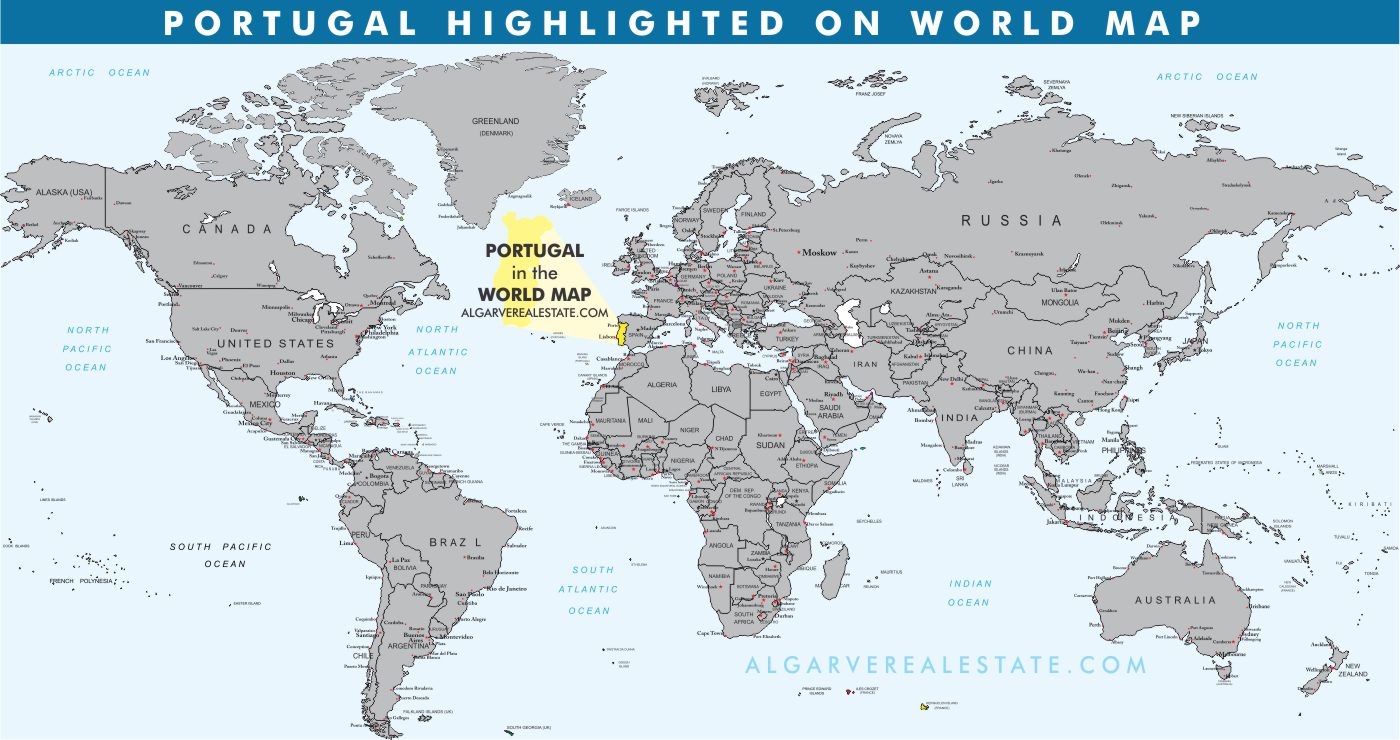
World map with Portugal highlighted in yellow. This map is part of the article Portugal
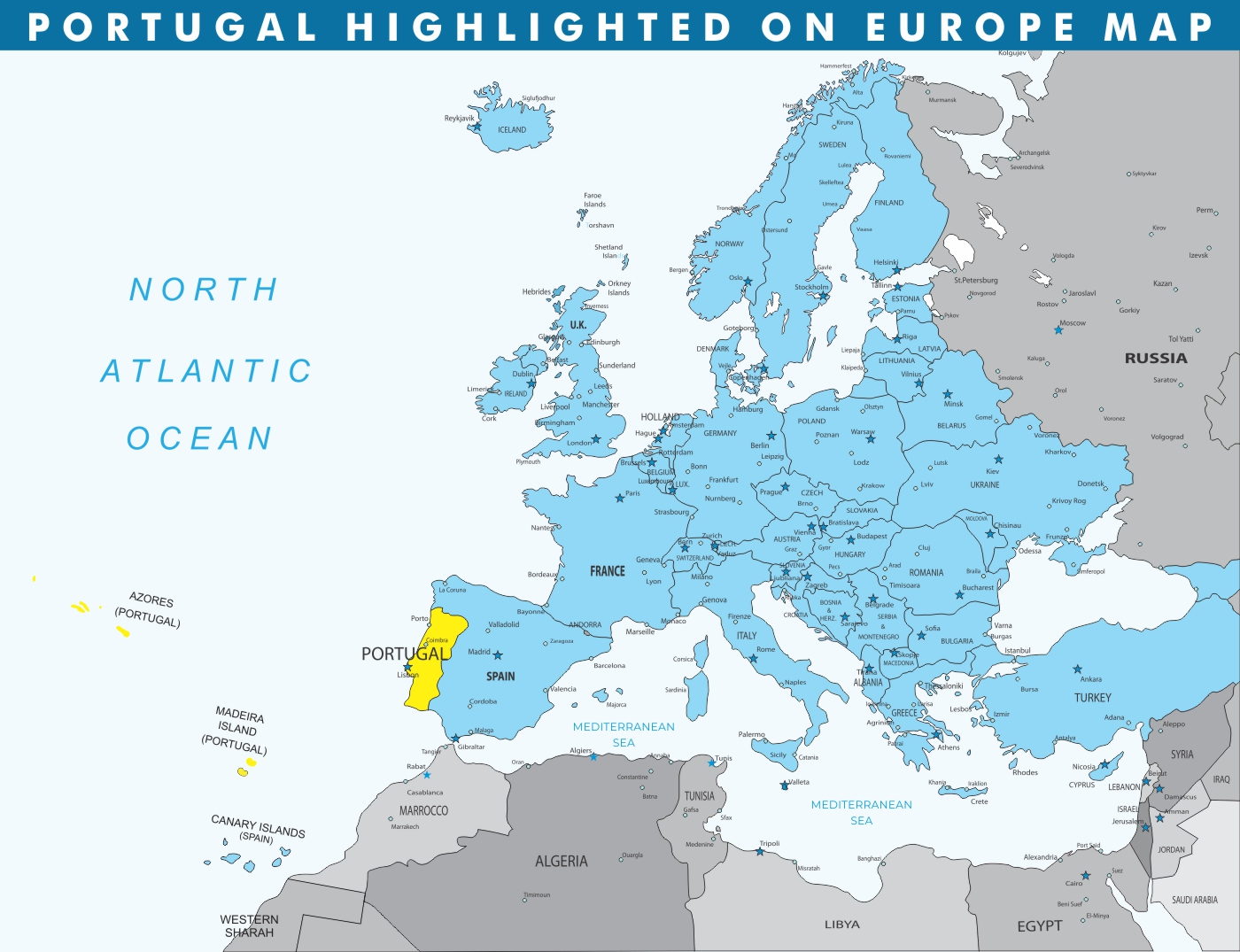
Portugal highlighted on Europe map. This map is part of the article Portugal
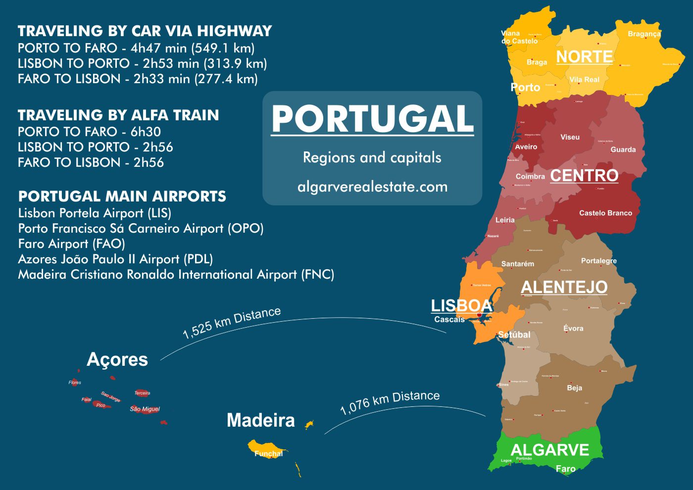
Map of Portugal with the regions, districts, distances between major cities and islands of Azores and Madeira. This map is part of the article Portugal
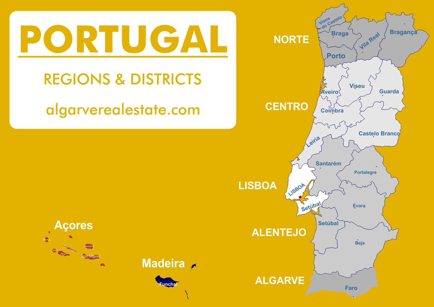
Map of the 7 regions and districts of Portugal. This map is part of the article Portugal
These maps are created and adapted by the ARE design team for our southern Portugal website. We regularly update new maps to help our customers understand Portugal from a more simplified point of view. For maps of other places in Portugal, we invite you to visit our other website lisbonproperty.com

